
The Lost Art of Reading the Night Sky
Before GPS and smartphones, ancient sailors and travelers relied on celestial navigation basics to find their way across oceans and deserts. The stars were their map, compass, and clock—a cosmic GPS that never needed batteries. By learning a few simple techniques, you too can read the sky like an ancient navigator.
Stargazing connects us to our ancestors who looked up and saw patterns that guided them home. It’s a skill that transforms the night sky from a random sprinkle of lights into a meaningful, navigable chart.
The North Star: Your Celestial Beacon
In the Northern Hemisphere, Polaris—the North Star—is the ultimate anchor for navigation. It sits almost exactly above Earth's North Pole, so as the Earth rotates, Polaris stays fixed in the sky while other stars circle around it.
Find it by locating the Big Dipper's 'pointer stars' (Merak and Dubhe), which point directly to Polaris.
Once you’ve found Polaris, you can determine your latitude: the angle of Polaris above the horizon equals your latitude. Understanding these celestial navigation basics allows you to orient any map or direction accurately. Facing Polaris means you’re looking due north, so you can set your bearings.
Why Polaris Is So Reliable
Unlike other stars that rise and set, Polaris remains at a nearly constant position all night, every night. This makes it an ideal reference point for navigation.
Ancient Polynesians, Vikings, and countless explorers used this 'north star' to stay on course.
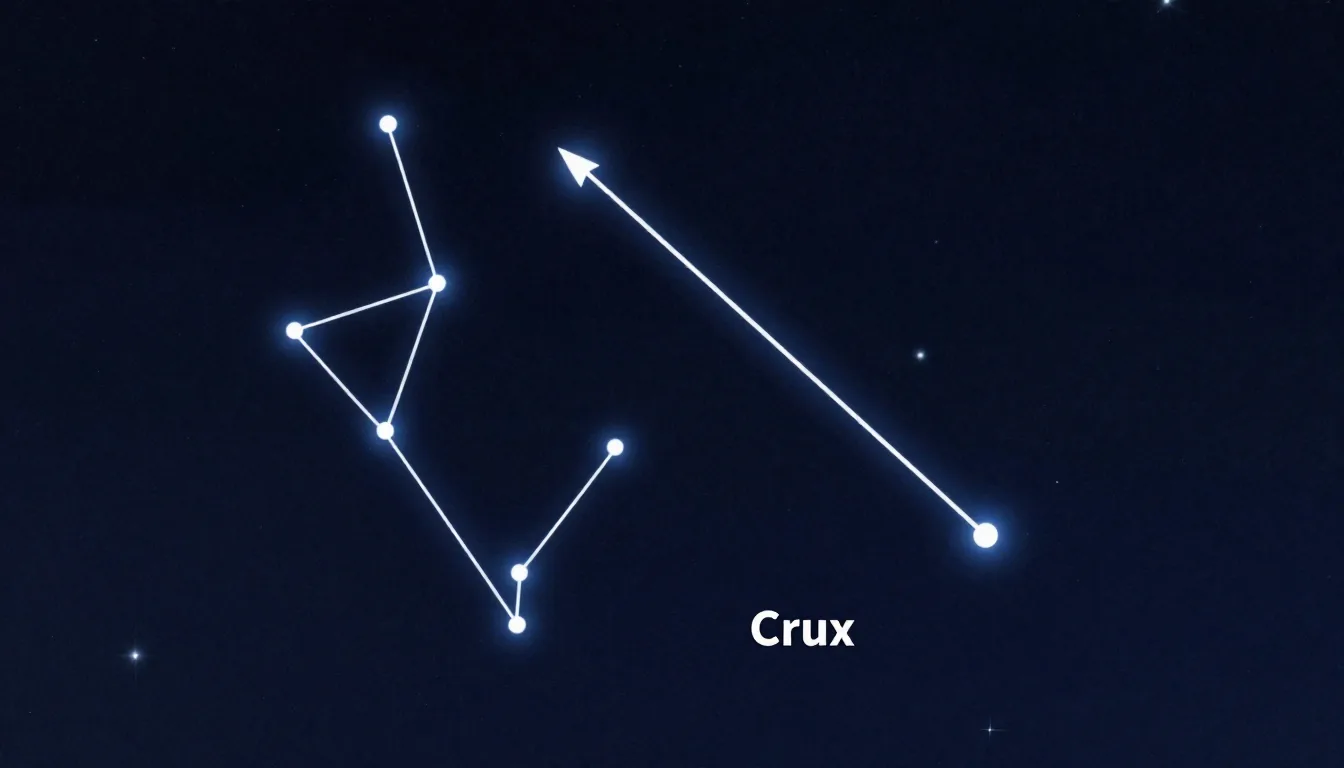
The Southern Cross: A Beacon for the Southern Hemisphere
For those below the equator, Polaris is invisible, but the Southern Cross (Crux) takes its place. This compact constellation of four bright stars points roughly toward the South Pole.
Draw an imaginary line from the top and bottom stars of the cross, extend it by about 4.5 times the cross's length, and you'll find the south celestial pole.
Unlike Polaris, there’s no single bright star at the south pole, so you use the Southern Cross as a pointer. Mastering celestial navigation basics here means learning to spot Crux to always know where south is, even in unknown territory.
Using Constellations as a Map
The entire night sky is divided into 88 constellations, each a landmark in the celestial sphere. Learning a few key constellations—like Orion, Cassiopeia, and the Big Dipper—allows you to navigate by their positions relative to the horizon.
Orion, for example, rises in the east and sets in the west, giving you cardinal directions.
Seasonal changes also help: constellations visible in winter differ from those in summer. By noting which constellations appear at a given time of year, you can estimate both time and direction. The Popular Science & Space archive has more guides on seasonal skywatching.
Mastering Celestial Navigation Basics
To truly master celestial navigation basics, practice locating Polaris and the Southern Cross in their respective hemispheres. Then, learn the ecliptic—the path the Sun and planets follow—and how to use the Moon's phase and position for direction.
For example, a crescent Moon in the evening sky always points toward the Sun, which sets roughly west.
Combine these skills: find Polaris for north, use the Southern Cross for south, and use the rising and setting of stars for east-west orientation. With dedicated practice, these celestial navigation basics become second nature, making you your own GPS.
The Joy of Star Navigation
Navigating by stars isn't just practical—it's deeply rewarding. It connects you to thousands of years of human exploration and wonder.
Next time you're out on a clear night, look up and try finding Polaris or the Southern Cross. You'll see the sky not as a random scatter, but as a map waiting to be read.
For further learning, check out NASA’s guide to star navigation or Time and Date’s constellation guide. Embracing these celestial navigation basics opens up a universe of exploration.

